YCGL - To Yellowstone and Beyond - Sept 9, 2022
I'm on the move again, and off to Lander at this time. I know, there are a lot of you out there that are saying Ayres Bridge and Lander are not the most direct route to Cody. And my answer to that, "And your point is????" This is my trip and I'll do it my way.... so there.
Actually, I've wanted to see Ayres Bridge for years, and thought I was going to on my last Casper trip. Only, it didn't happen then, and this was my next chance, so why miss it?
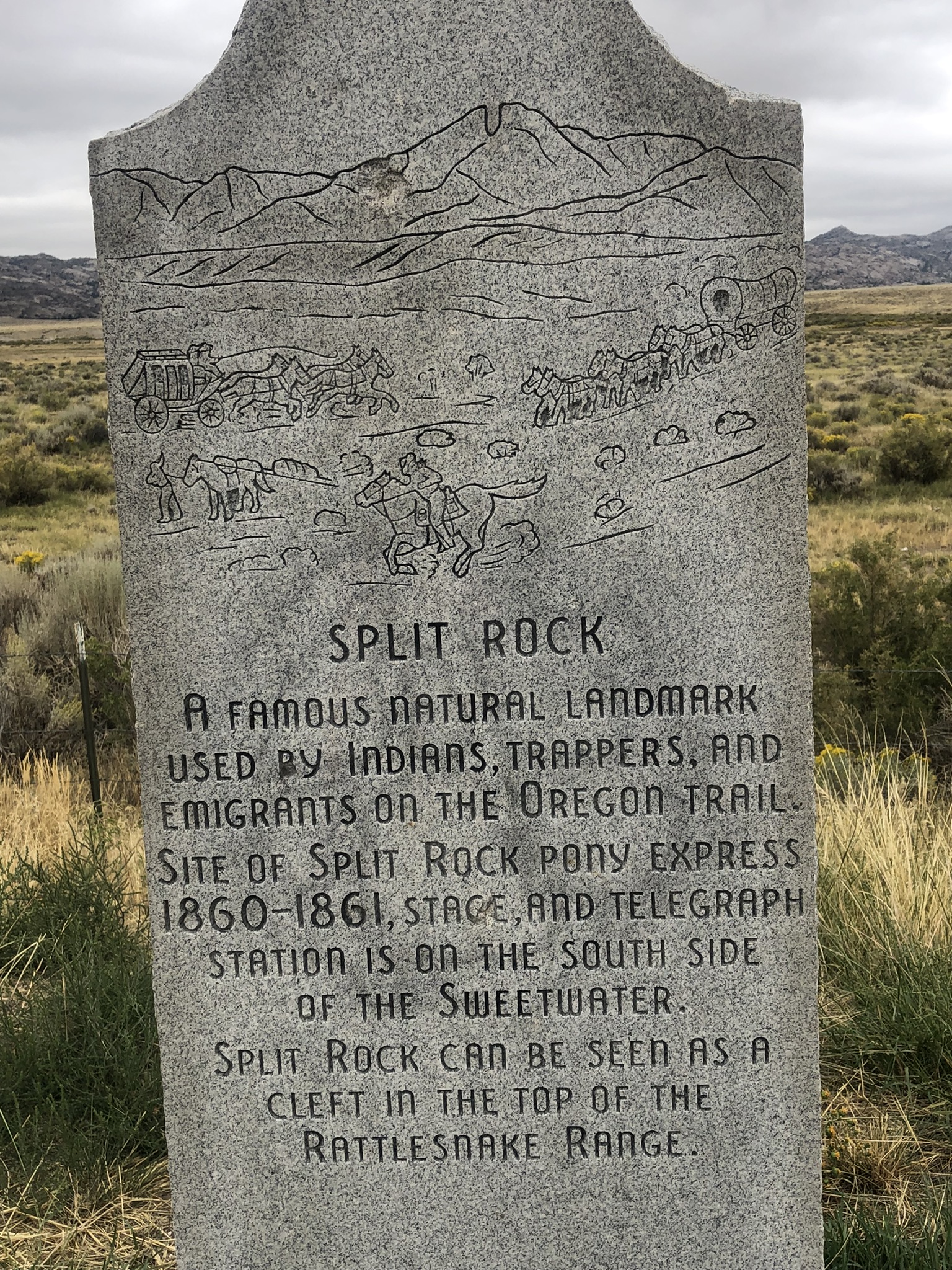
Second, I really got a lot of ideas from the Casper trip about the Oregon/Mormon/California trails. They all followed the North Platte from Douglas to Casper to Independence Rock to Split Rock to Sweetwater Junction and then towards Lander. And that was the path that I wanted to follow.
There is a portion of the road that I have not traveled much, like maybe two or three times in the last forty years. If I'm going to Casper, I'll take the route through the Shirley Basin. Likewise, if I'm traveling to Lander or Riverton, I'll go through Rawlins, so the segment between Casper and Muddy Gap is foreign to me, so here was my chance to correct that. That segment parallel's the trails, but is about two to four miles east of the most used route, being more important to having minimum slopes for the oxen or people to travel rather than the straightest path like the highway.
The first major landmark on the road is Independence Rock. This is a big rock outcrop that was visible for many miles. Its significance was that if you made it to Independence Rock by Independence Day (the 4th of July), you would likely reach your destination before snowfall. For example, the famed Donner Party was at Fort Laramie on the 4th of July and didn't reach Independence Rock until July 17.

Sadly, it was too cold, windy and rainy to walk out to it. Next time I drive through, I guess.


Comments
Post a Comment